Important Update:
Read More


- Everything you need under one roof
- WPL, The most feature-rich platform based on Wordpress
- Owned License Model
- One Time License Purchase
- More than 150,000 Clients from 110 Countries
- 95% Client Satisfaction – Proven Track Record
- More than 25 Million Lines Of Code
- Customization Service
100% DEDICATION TO
REAL ESTATE TECHNOLOGY
REALTYNA®
- Everything you need under one roof
- WPL, The most feature-rich platform based on WordPress
- Owned License Model
- One Time License Purchase
- More than 150,000 Clients from 110 Countries
- 95% Client Satisfaction – Proven Track Record
- More than 25 Million Lines Of Code
- Customization Service


All You Need For Your Real Estate
Website Under One Roof
WPL
- Powerful & Feature-rich Core
- Flexible & Dynamic Data Structure
- Flexible Design and Themes
- Wide Range of Add-ons
- Search Engine Friendly
- And much more...


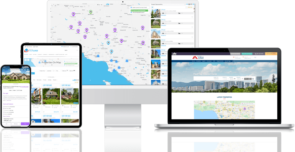
- Advanced Android / iOS Mobile Apps
- Custom Brand: Publish it under your name
- Automatic Listing Sync with WPL and MLS
- Slick & Smooth
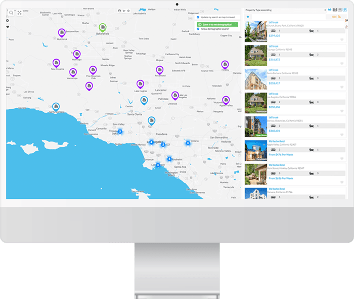
- Impressive Map Search
And more...
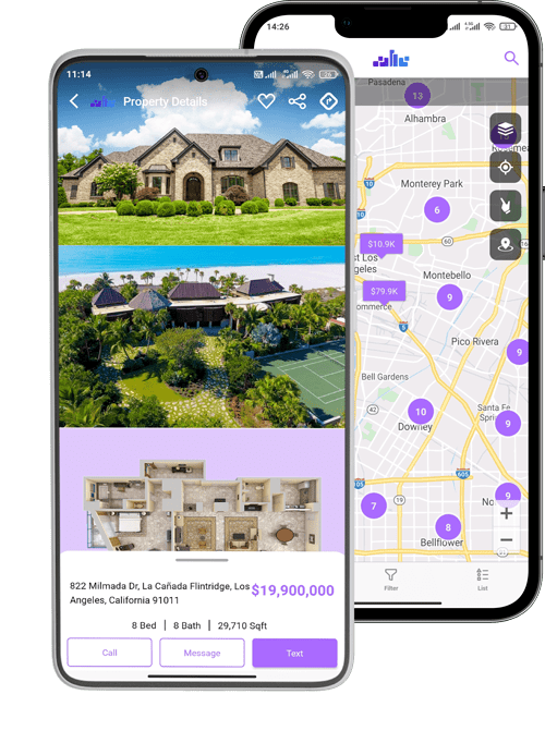
REAL ESTATE MOBILE APPS
Mobile App


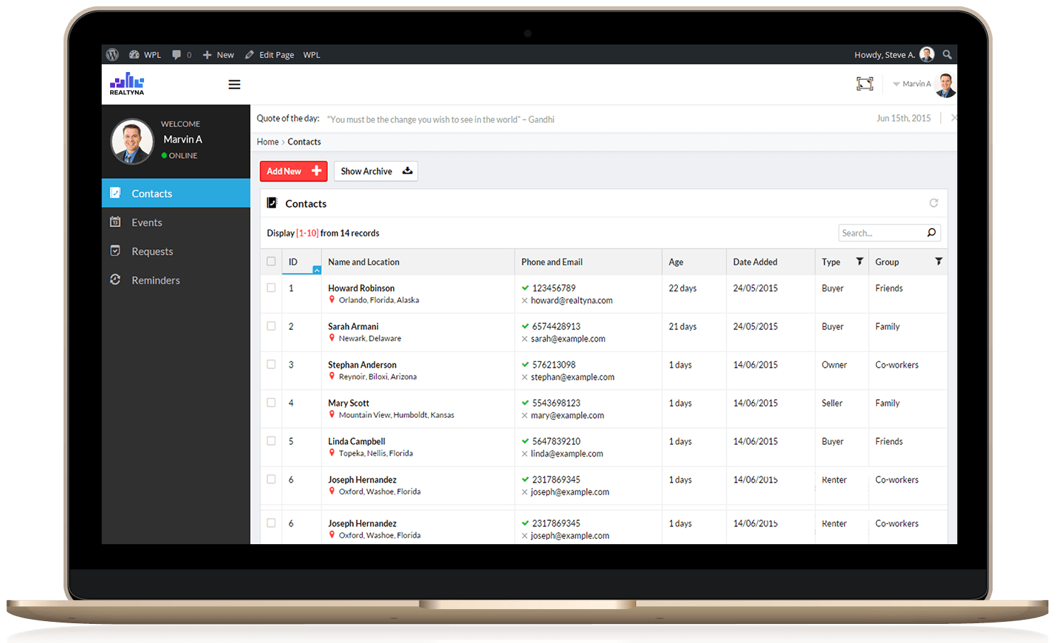
- Lead Generation & Management
- Lead Monitoring
- Multiple Lead Assignments Methods
- Unlimited Agent Support
- Communications through ticketing system
- Flexible Email Notifications
- Possibility of SMS Notifications
- Event Management and Sync
And more
REAL ESTATE CRM
CRM


- Cloud Server Support
- Optimized for Real Estate
- Optimized for MLS Integration
- Valid Server IP Address
- Full CPanel/ DB / FTP Access
- Very Scalable
All You Need For Your Real Estate
Website, Under One Roof
Website, Under One Roof
HOSTING
WELCOME TO Realtyna®
If you are looking for a flexible, scalable and affordable web / mobile solution for your Real Estate business, you are in the right place.
ALL YOU NEED FOR
YOUR REAL ESTATE WEBSITE
UNDER ONE ROOF
Some Important Facts About Realtyna® Solutions
WPL
An independent full platform based on the most famous CMS: WordPress, with hundreds of features and lots of useful add-ons
25 Million+ Lines of Codes
Only for Real Estate technology
Organic Data Feed Integration
A number of different add-ons for covering all standard data feed integration: MLS, IDX, RESO, XML, CSV, DDF and VOW
Top Notch Mobile Apps
Android / iOS native apps that can be re-branded and published for you
Enterprise Solutions
MLS RESO Server, Franchise/Brokerage Multisite Solutions
Clientele
Proven track record from 2007, with 270,000+ Downloads
Customer Service / Support
Exceptional customer service with the highest client satisfaction rates
One year of complimentary support
Optional support renewal from the second year
License Model
Owned License Model; One time payment
Lifetime Updates for the majority of the products
Hosting / Server
Choose any hosting provider that meets Realtyna® technical requirements. Realtyna® also offers optional managed hosting optimized for our solutions
10+
Years of Experience
25 Million
Lines of Codes for Real Estate Applications
270,000+
Downloads
95%+
Client Satisfaction Rate

Realtyna® Mobile Application
Publish an iPhone/Android Real Estate App for Your own Brand!
Realtyna® has developed a very advanced and fast Mobile App, that can be rebranded and paired with our client’s website to show their listings on both Android and iOS.
Demo Websites
Looking to test our products before you buy? We’ve built two demo sites (one for our base package, one with our suite of add-ons). These sites are populated with sample data for you to learn the functionalities of our platform. If you’d like to try our products with full admin access, contact us for a development area built just for you.